The National Forests in Florida manages the Florida Trail. It “provides ways to get out in the woods and view natural Florida that are immeasurable to the health and well-being of all its hikers,” said Forest Supervisor Susan Jeber-Matthews. “The Forest Service takes great pride in the role we play in providing this opportunity.”
Florida is much bigger than it looks on a map. The second-largest state east of the Mississippi River, Florida stretches across two time zones, and it takes about 12 hours to drive from Pensacola to Key West. More than half the length of the Appalachian Trail, the Florida Trail has no mountains to showcase—the high points in the western corner of the state barely top 300 feet. But what Florida has is botanical diversity, with every few inches of gradient yielding to an entirely new habitat. The Florida Natural Areas Inventory includes 81 different natural communities ranging from dry upland
hardwood forests in Florida’s Panhandle— with ravines and bluffs and plant life similar to those found in the Appalachians—to tropical hammocks topped with trees common to the Caribbean islands. While most of the buzz about the Florida Trail surrounds its swamp crossings, the trail itself is mainly dry, traversing upland areas along the spine of the Florida peninsula. Yet it’s these swampy habitats that intrigue visitors the most, with landscapes that look nothing like the rest of America.
Wet and Wild
Wading into the Big Cypress Swamp seems like an odd way to start a thru-hike, but the southern terminus of the Florida Trail lies in the midst of a watery wilderness. “Those who hike the Florida Trail through the Preserve discover that the southern end of the trail is some of the most challenging hiking, but at the same time some of the most secluded and beautiful portions of the trail,” said Bob DeGross, chief of interpretation and public affairs at Big Cypress National Preserve.
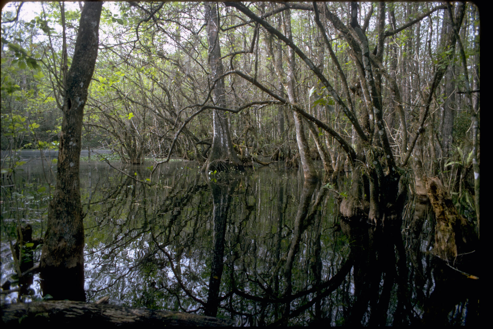
That first step into the water is always a shock. Big Cypress and the Everglades are shallow rivers of rainwater moving slowly but steadily down a slight gradient towards the Gulf of Mexico and Florida Bay through the southernmost tip of the Florida peninsula. During the summer, when daily thunderstorms are a given, the water may rise several feet deep and flow quickly southward. During the winter, shallow sawgrass prairies dry out, with water cached only in the center of cypress domes and the deeper channels that define cypress strands. Wading, however, is a part of your progress through the swamp, no matter the time of year, through crystal-clear water glimmering with tiny fish—gambusia— that eat mosquito larvae. Colorful floating bladderworts also contribute to mosquito control, so Big Cypress is not as buggy as adjacent Everglades National Park.
Immersed in a cypress dome, you’re surrounded by the delicate beauty of colorful bromeliads, orchids, and the lichenmottled bark of the trees. Jurassic-sized ferns tower overhead in shallower areas. As elevation rises a tiny bit, the landscape opens up to panoramas of prairie, where a glimpse into the grasses yields splashes of purple, yellow, and orange like an impressionist painting. It is not an easy place to hike. When damp, the webs of periphyton (a complex mix of algae, bacteria, and fungi that makes up the primary biomass of the Everglades) underfoot have the consistency of shortening, meaning hiking poles are a necessity to keep yourself upright. There are deep holes in the oolite bedrock that only probing ahead can uncover. Dry spots for camping are limited. But the reward of experiencing these rare habitats up close and personal makes it worth the hike.
Around Okeechobee
I’m being lazy this morning, letting the rest of my group get an early start while I focus on photography. It’s day six of the Big O Hike, Thanksgiving Day, and I’m settled in a little way from the trailhead at Moore Haven watching the sun rise. For nearly an hour, a symphony of color unfolds, scattering yellows, oranges, and pinks across the sky as first light dapples across tall grasses, moonflowers, and sugar cane fields. As morning seeps overhead, birdsong echoes across the expanse of marshes as the lead hikers come into view.
The longest running organized hike in Florida, the Big O Hike celebrates 20 years in 2011—nine days of day hiking around Lake Okeechobee, an inland sea that’s the second-largest lake entirely within U.S. borders, right after Lake Michigan.
In the 1920s, two hurricanes upturned the shallow bowl into surrounding farming communities, killing thousands. The government response was to encircle the lake with a 35-foot-tall dike and flood control gates, cutting off the flow of the largest source of water feeding the Everglades.
Held during Thanksgiving week, the Big O Hike attracts hikers from all over North America for both the physical challenge of one of the longest loop hikes around a lake—109 miles—and the camaraderie found while hiking, relaxing, and exploring the communities around the lake. With expansive views into sugar cane fields and cattle ranches from atop the dike, hikers are immersed in rural South Florida while enjoying the expansive views.
Up the Kissimmee
Camped beneath the oaks of Blueberry Hill, I awake at the break of dawn to muffled moos. A peek through the tent zip reveals cattle silhouetted beneath cabbage palms lit from behind by the rising sun. Mist gathers in pools, creeping up from the nearby Kissimmee River. I’d tiptoed through the cow patties before dusk to draw water from the river. This morning, the cows are on the other side of the fence. Once we breakfasted and packed, we’d be up and over the next stile into their pasture in the midst of Florida’s largest prairie, crossing ranches established in the 1820s and still in the same families, following the Florida Trail as it traces the flow of the Kissimmee River north.
With its headwaters near Walt Disney World, the Kissimmee River basin has seen a world of hurt over the past century. In 1881, land speculator Hamilton Disston talked the state of Florida into selling frontier swampland to him for pennies on the dollar on a promise of draining the swamps. It was purportedly the largest land purchase in human history. Drain he did, all the way down to the Everglades, changing the face of Florida forever. Where the peninsula was once a mosaic of wet and dry prairies punctuated by pine forest, it became the realm of cattlemen overseeing ranches on a Texas scale.
The Army Corps of Engineers straightened the sinuous Kissimmee River by turning it into a canal in the 1960s in the name of flood control. Once the wetlands that filtered the water were destroyed, the heavy agricultural nutrient load washed right into Lake Okeechobee, altering its chemistry and spilling over into the Everglades. Since 2000, the Comprehensive Everglades Restoration Project has been slowly undoing these mistakes by restoring the natural flow of the Kissimmee River into Lake Okeechobee and the Everglades.
Along the Kissimmee River, the Florida Trail follows a well-established cattle drover route from pioneer days, passing through ghost towns once serviced by steamboats. Much of the river is still a ditch. But in places like Bluff Hammock, where the natural flow has been restored, the marshes spread out for miles, echoing with the cries of sandhill cranes en masse each winter to feast.
In the Ocala
(Birthplace of the Florida Trail)
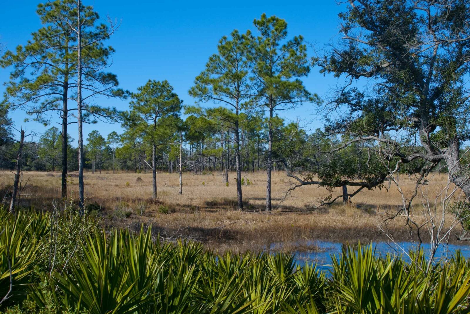
Walking through the heart of the Juniper Prairie Wilderness, I come to a dead stop as I hear splashing ahead of me. In the middle of the Big Scrub, the largest contiguous sand pine scrub forest on Earth, I’m in Florida’s desert, clambering ancient dunes made of bright white sand topped with plants adapted to a harsh environment.
While designated a National Scenic Trail in 1983, the Florida Trail’s roots run deeper. In the early 1960s, Miami resident Jim Kern—a Florida Audubon Society member—came back from a camping trip on the Appalachian Trail with the desire to create a place where Florida backpackers could take to the woods. Bringing together environmental luminaries of the time, including Marjory Stoneman Douglas and Ross Allen, he founded the Florida Trail Association. Kern led an expedition north through the wilds of the Big Cypress Swamp to Lake Okeechobee, accompanied by a reporter from the Miami Herald. The published tale of the adventure brought more eager hikers out of the woods, and a movement was born. The first segment of the Florida Trail opened in 1966 near Clearwater Lake Recreation Area, and the first section completed was across the entire Ocala National Forest. Spanning nearly 70 miles of unbroken trail, it’s a major attraction for backpackers in Florida.
Still providing on-the-ground volunteer support, the Florida Trail Association (www.floridatrail.org) works hand-inhand with the National Forests in Florida to build, maintain, and promote the trail. “FTA’s partnership with the National Forests in Florida is central to protecting and preserving one of only 11 National Scenic Trails in the United States,” said Peter Durnell, president of the Florida Trail Association. “Providing the public with a safe experience of Florida’s natural wonders that is challenging, interesting, accessible, and educational is our combined goal.”
Marvels of the Panhandle
The Florida Trail’s center point lies north of the Ocala National Forest, speaking to just how far a traverse it is across North Florida and the Florida Panhandle. Hikers spend more than 20 miles crossing the Osceola National Forest—known for its red-cockaded woodpecker colonies and biological connectivity to the Okeefenokee Swamp. The big push, with no resupply options for backpackers, is more than 80 miles across the Apalachicola National Forest, the home of the aforementioned Bradwell Bay and expansive, albeit wet, pitcher plant savannas.
As the Florida Trail heads westward, the terrain gets more rugged, with steephead ravines and tall waterfalls, hilly longleaf pine habitat, and rocky karst outcrops where springs bubble from the earth. The trail weaves its way back and forth between the Gulf coast and the Georgia border. At St. Marks National Wildlife Refuge—the only National Wildlife Refuge in America where overnight camping is permitted (but only for Florida Trail backpackers)—the trail swings out along the edge of vast coastal estuaries. By the time it reaches Pensacola Beach, it spills out along snowy white sands for the final stretch to the northern terminus at Fort Pickens in Gulf Islands National Seashore.
Gem of the Southeast
With nearly 150 trailheads within an hour of major population centers and vacation destinations, the Florida Trail is primarily the domain of day hikers and overnight backpackers. Only a handful of long-distance hikers make the attempt each season. Hiking season is reversed in Florida from the rest of the country, so the peak months—with cool weather and fewer insects—are October through April. “The Florida Trail is the gem in the crown of our recreational trail system,” said Forest Supervisor Susan Jeber-Matthews, and it indeed, is a gem with many unexpected facets.