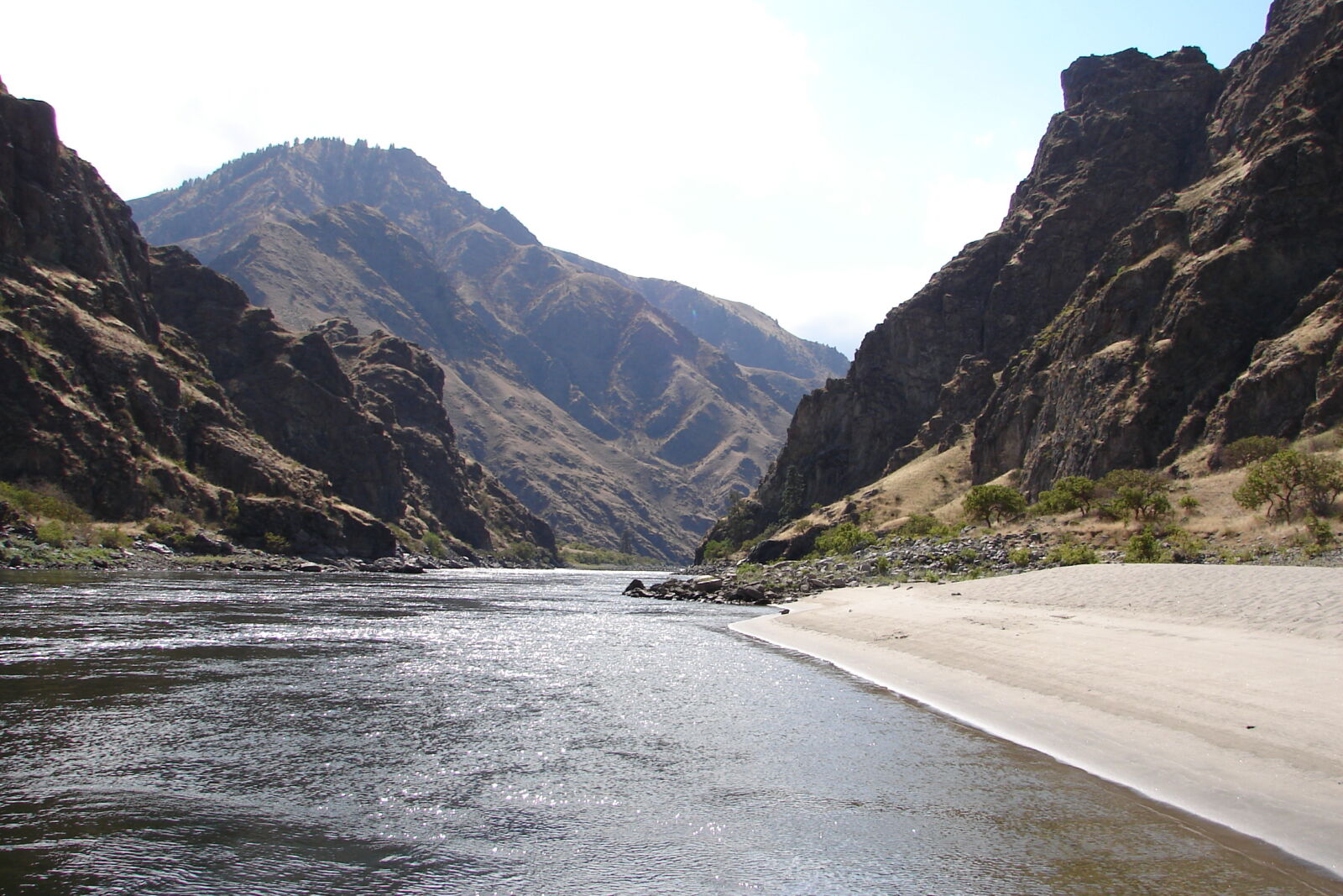
The Wallowa-Whitman National Forest and Eagle Cap Wilderness area covers 2.3 million acres in the Northeast corner of Oregon and a small section of Idaho. Morphed into its current form in 1954 by a combination of President Roosevelt’s Wallowa Forest Reserve and Whitman National Forest, this jaw-dropping landscape of sharp granite mountains, massive glacial lake and moraine, and series of winding rivers is both literally and figuratively Oregon’s “end of the road.” Trout and steelhead are abundant in local waterways, while deer, Rocky Mountain elk, big horn sheep, black bear, cougar and an occasional rare wolverine wander through the craggy peaks and old-growth forests. Hunters, anglers, skiers and campers all appreciate this land and its inhabitants during their prime seasons.
Many visitors—including native Oregonians— are struck with a “how-on-Earth-could- I-have-missed-this?” feeling when finally discovering this corner of the state.
This glacially-carved landscape showcases the variety in Oregon’s terrain because it is distinctively different than the well-traveled volcanic landscape of the Cascade Range in the east. At 9,838 feet, Sacajawea Peak is the highest point in the Wallowa Mountains and is home to an active glacier. Many who visit this National Forest enjoy hiking and mountain biking around this monolith and her nearby companions, but also enjoy the alternative; a 3,700 vertical foot gondola ride up Mt. Howard on the Wallowa Lake Tramway. Once at the top, visitors can either hike on a network of well-groomed trails, mountain bike down, or enjoy views of Oregon, Idaho and Washington while taking in a beverage at the Summit Grill and Alpine Patio.
Many visitors—including native Oregonians— are struck with a “how-on-Earth-could- I-have-missed-this?” feeling when finally discovering this corner of the state. Visitors also notice the tight-knit feeling of the communities they travel through—including the towns of Joseph, Enterprise, Imnaha, Wallowa and Lostine. With the help of local non-profit Wallowa Resources, communities here have worked together in recent years to create sustainable industries, fight invasive species, and provide an alternate vision to large-scale development in the area. From attending high school basketball games, to skiing and snowmobiling in the backcountry, to enjoying an ale at the brewery, residents here embrace their local culture and lifestyle.
Community is both an important part of the history of this land, and also a painful reminder. The tidy town of Joseph, which sits at the base of the Wallowas, is the namesake of Chief Joseph, a leader of the native Nez Perce people who inhabited the Wallowa Valley for hundreds of years before the arrival of European settlers. Joseph and the Nez Perce initially had a friendly relationship with the new arrivals. However, that changed when, after the discovery of gold, the settlers went back on a previously brokered land deal allowing the tribe to stay in the Wallowa Valley.
The federal government attempted to relocate the Nez Perce to a small reservation in what was then called “the Indian Territory.” Instead, Chief Joseph chose to abandon the area. He led his people over 1,000 miles toward freedom at the Canadian border. Joseph and the Nez Perce who followed him were outnumbered 10 to 1, but still defeated federal troops in numerous battles along the way. They were finally forced to surrender just 40 miles south of Canada. Today, grant programs and community encouragement are persuading the later generations of the Nez Perce to trickle back to the Wallowa Valley.